
Providing accessible orientation and interpretation for visitors and locals across Ireland’s second largest city
Building on the Visitor Orientation Strategy we completed for Cork City Council, and our own Signage With Purpose report commissioned by Fáilte Ireland, we undertook the research, design and production of a new suite of wayfinding totems and monoliths within Cork City.
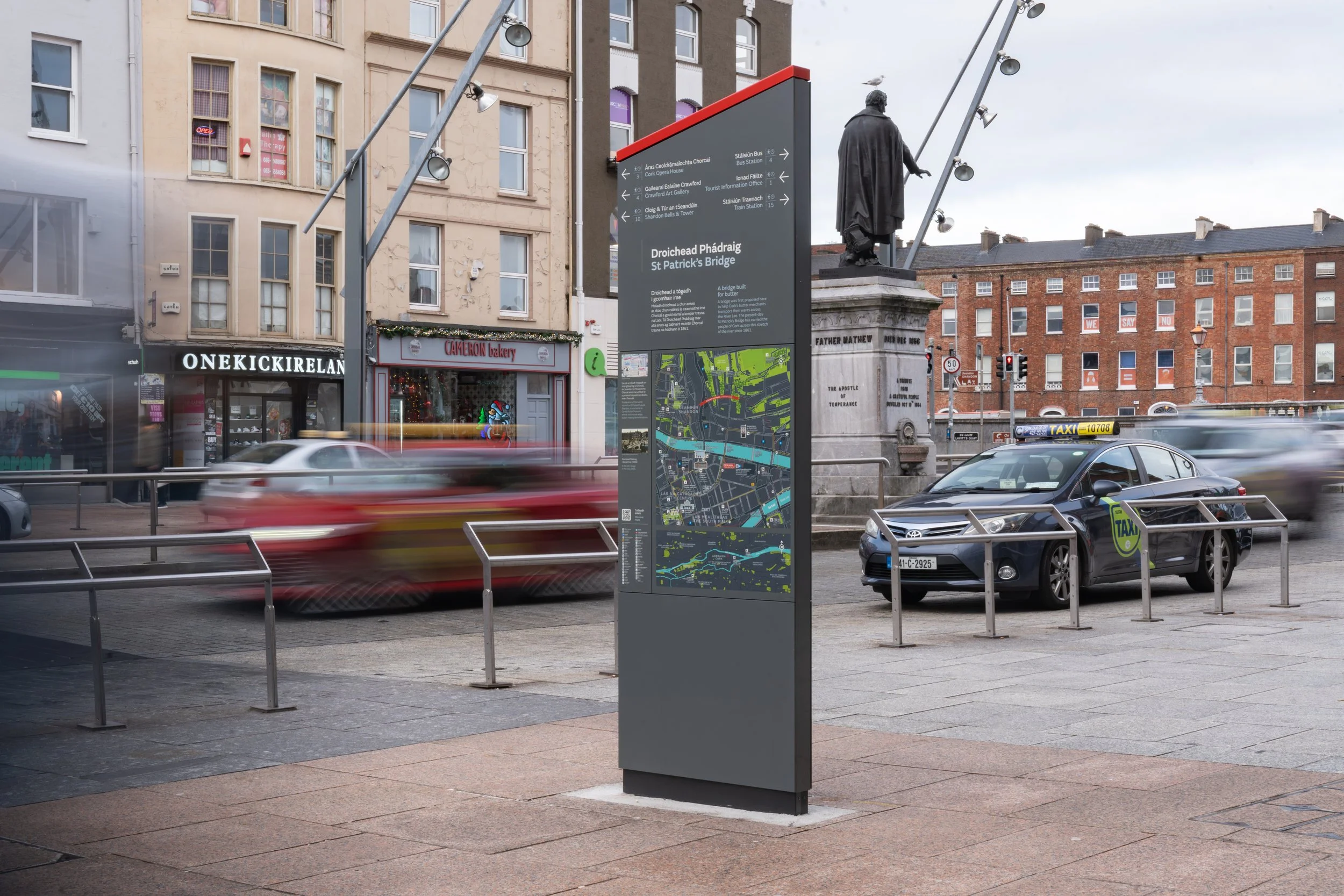
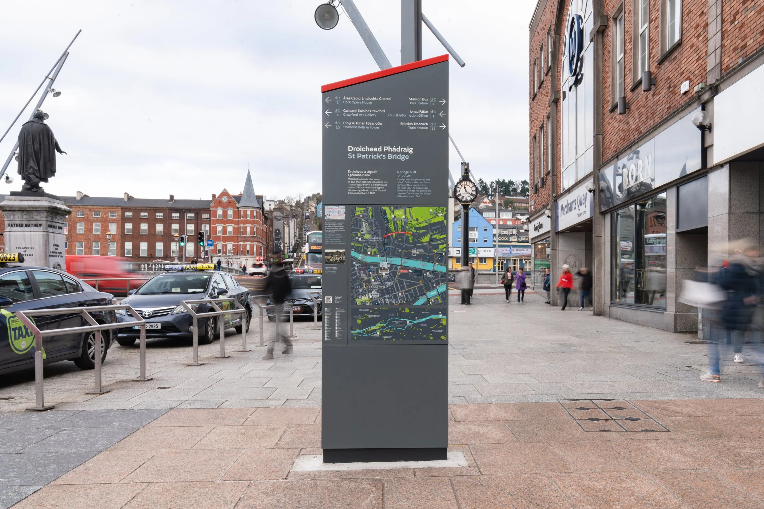
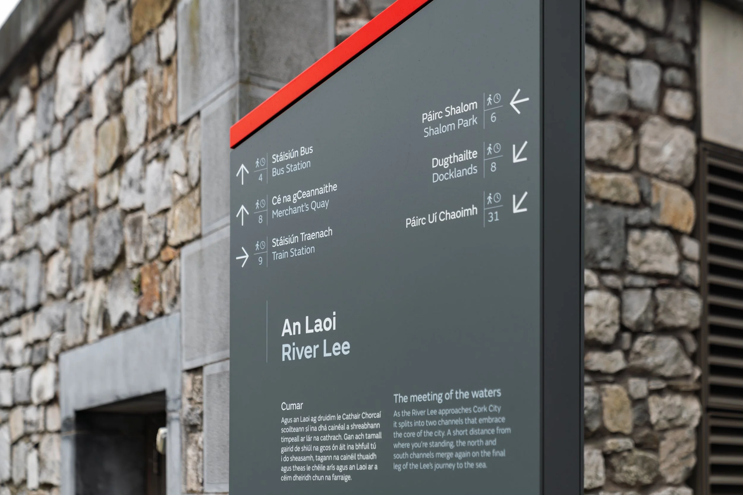
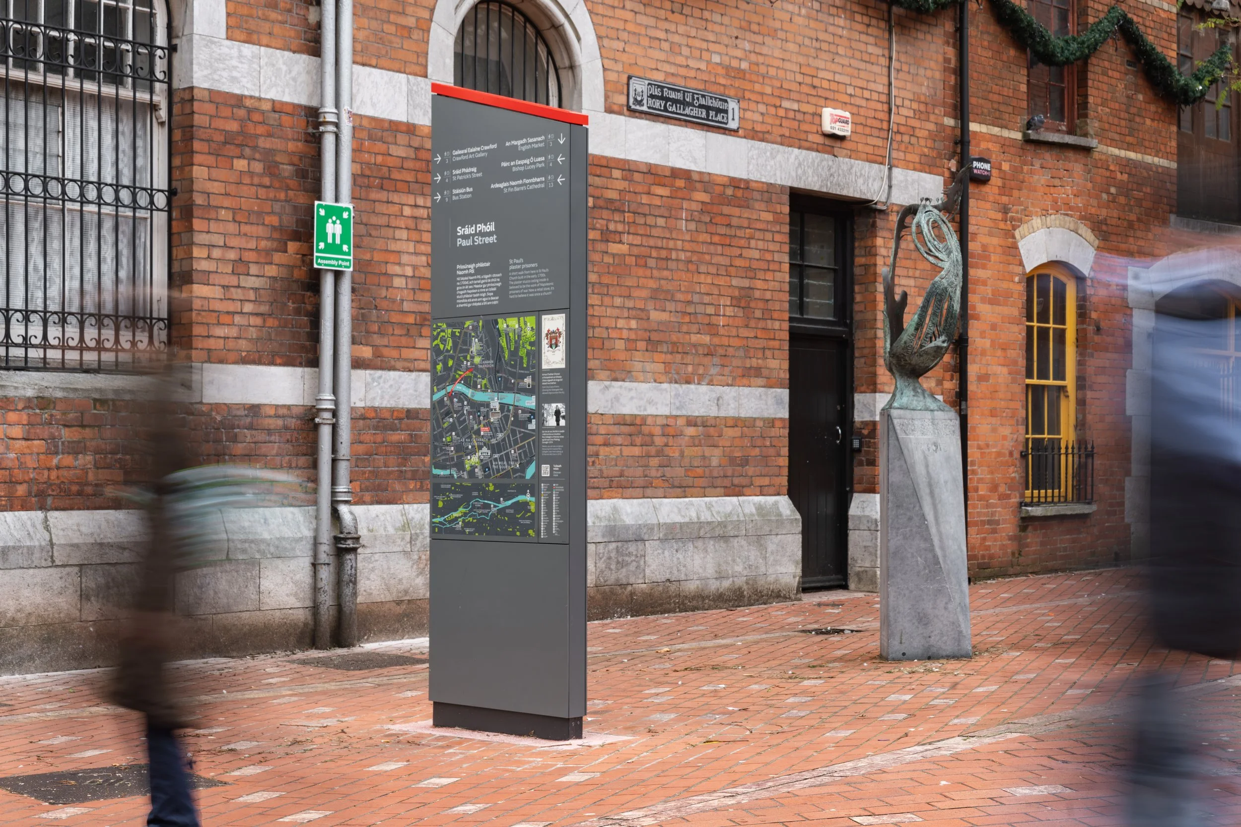
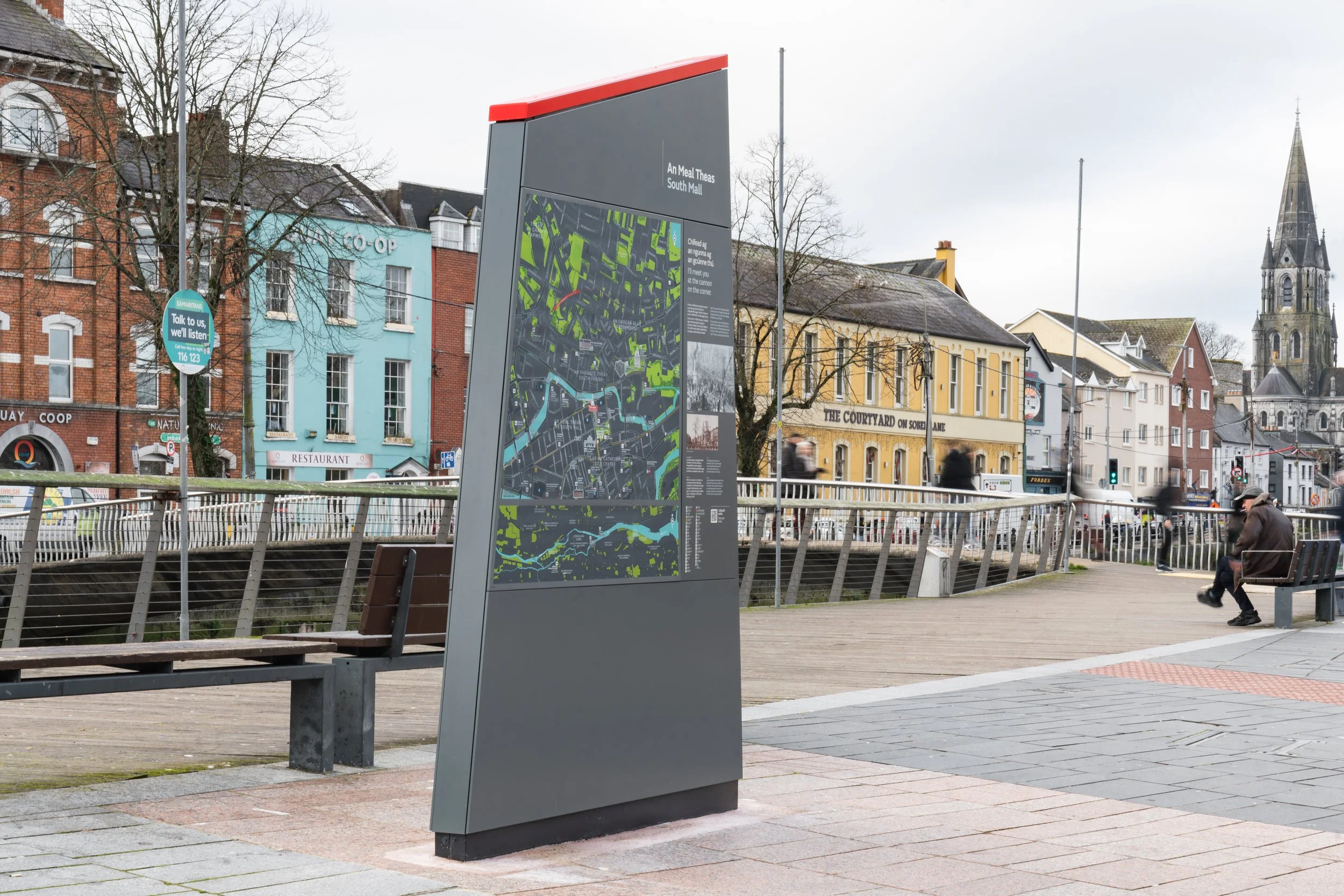
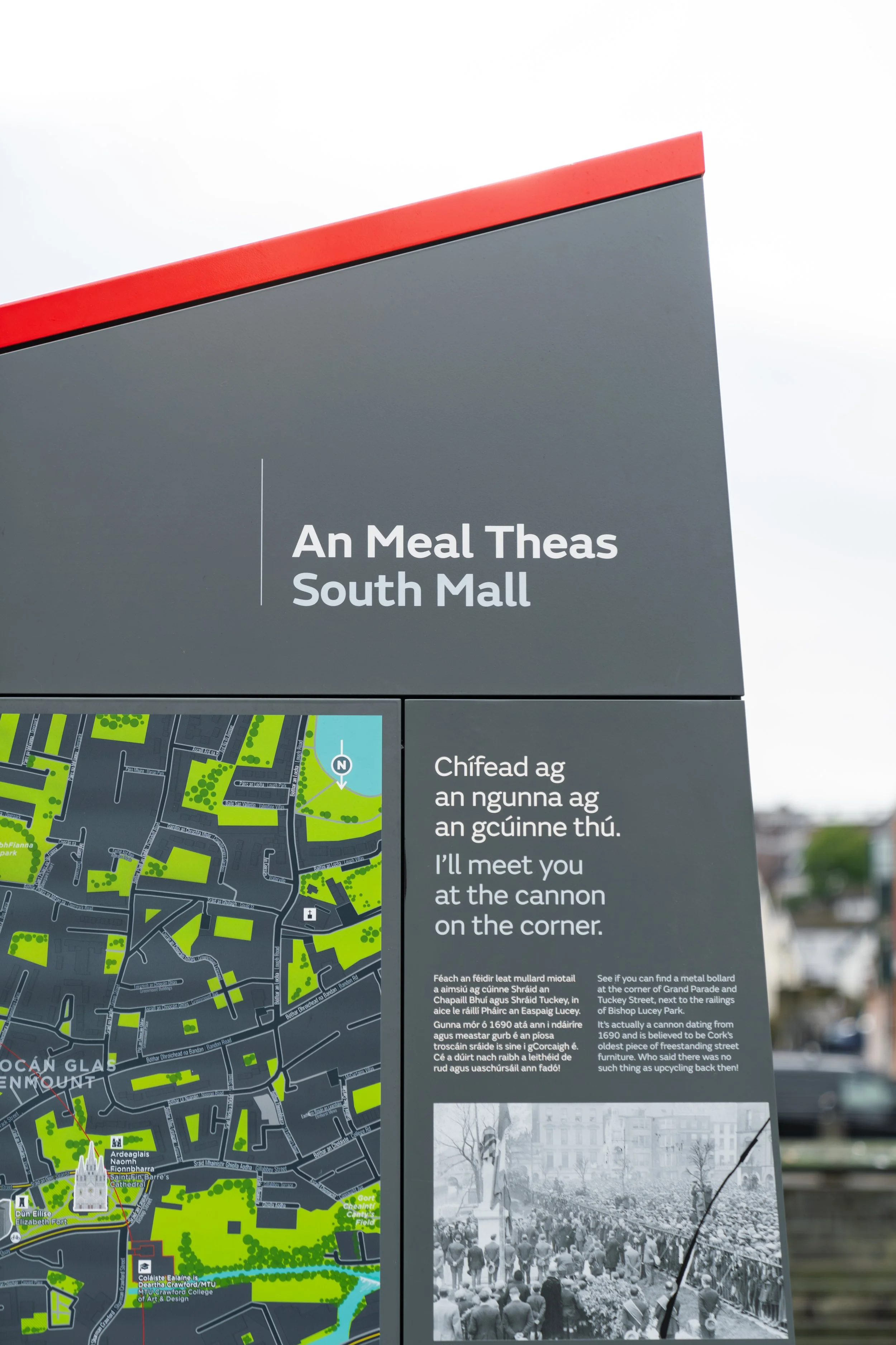
The city centre’s unique island layout, with river channels to its north and south, can make orientation challenging and confusing for visitors, according to Fáilte Ireland research. Informed by best practice in orientation, the new wayfinding scheme helps to connect attractions across the city and includes engaging interpretation around Cork’s lively character and heritage.
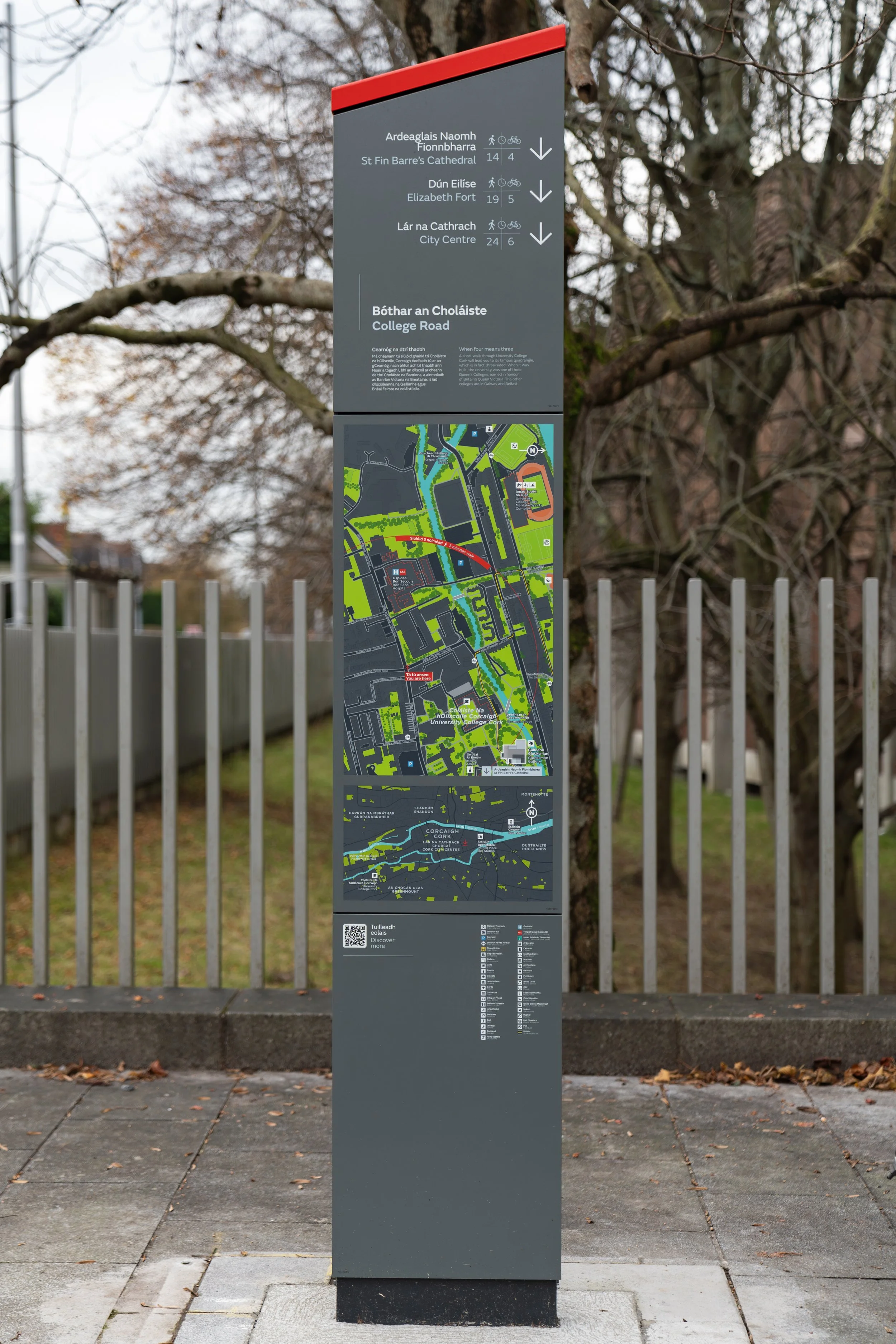
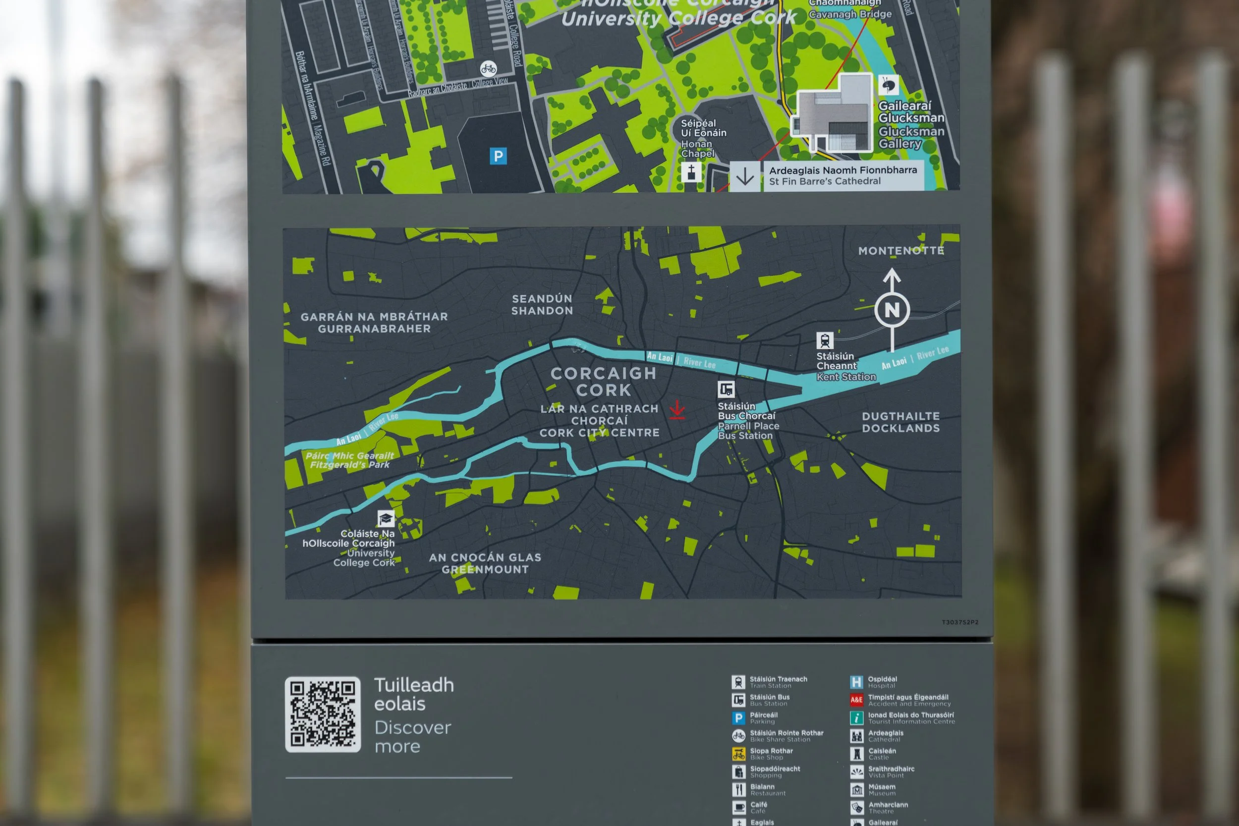
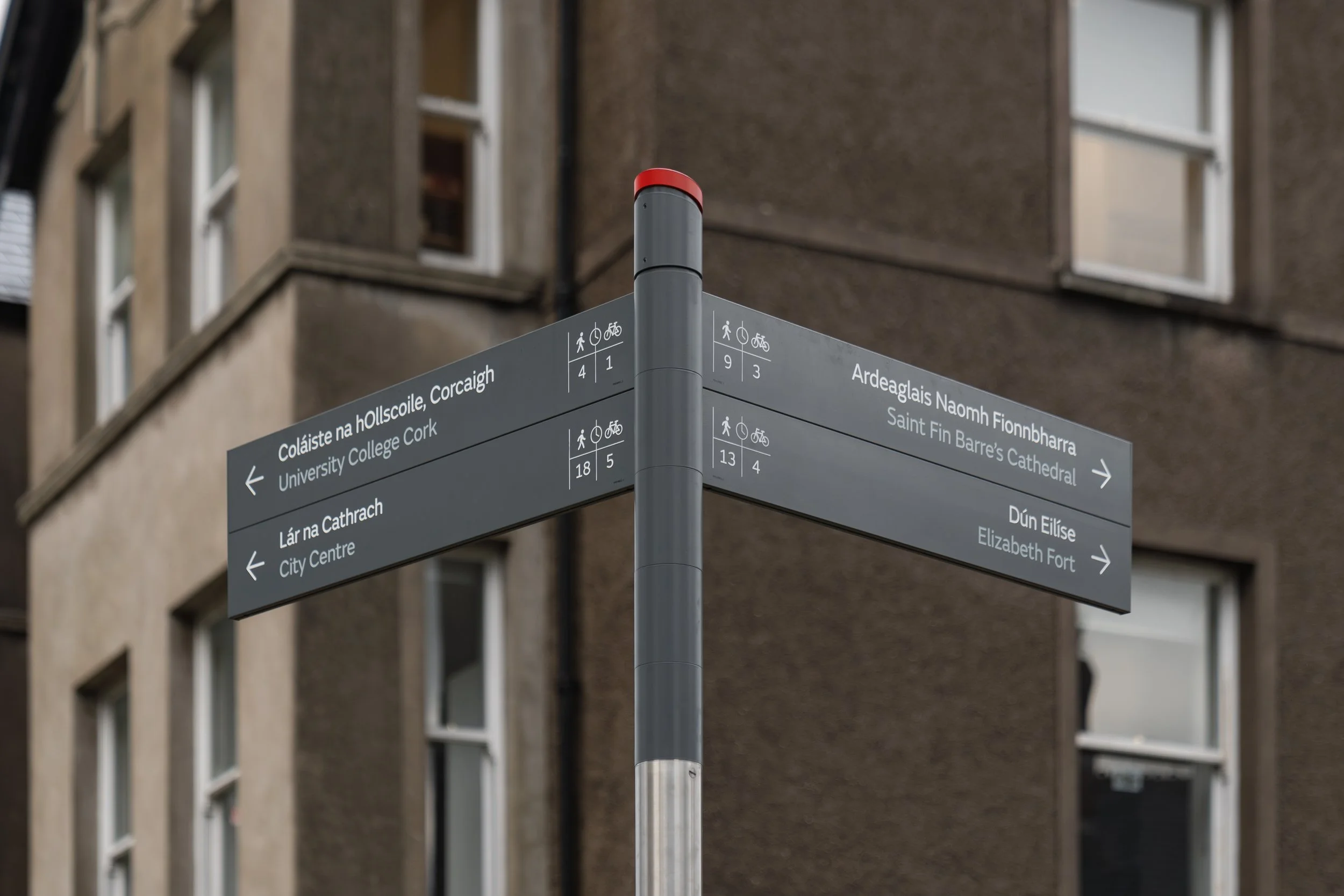
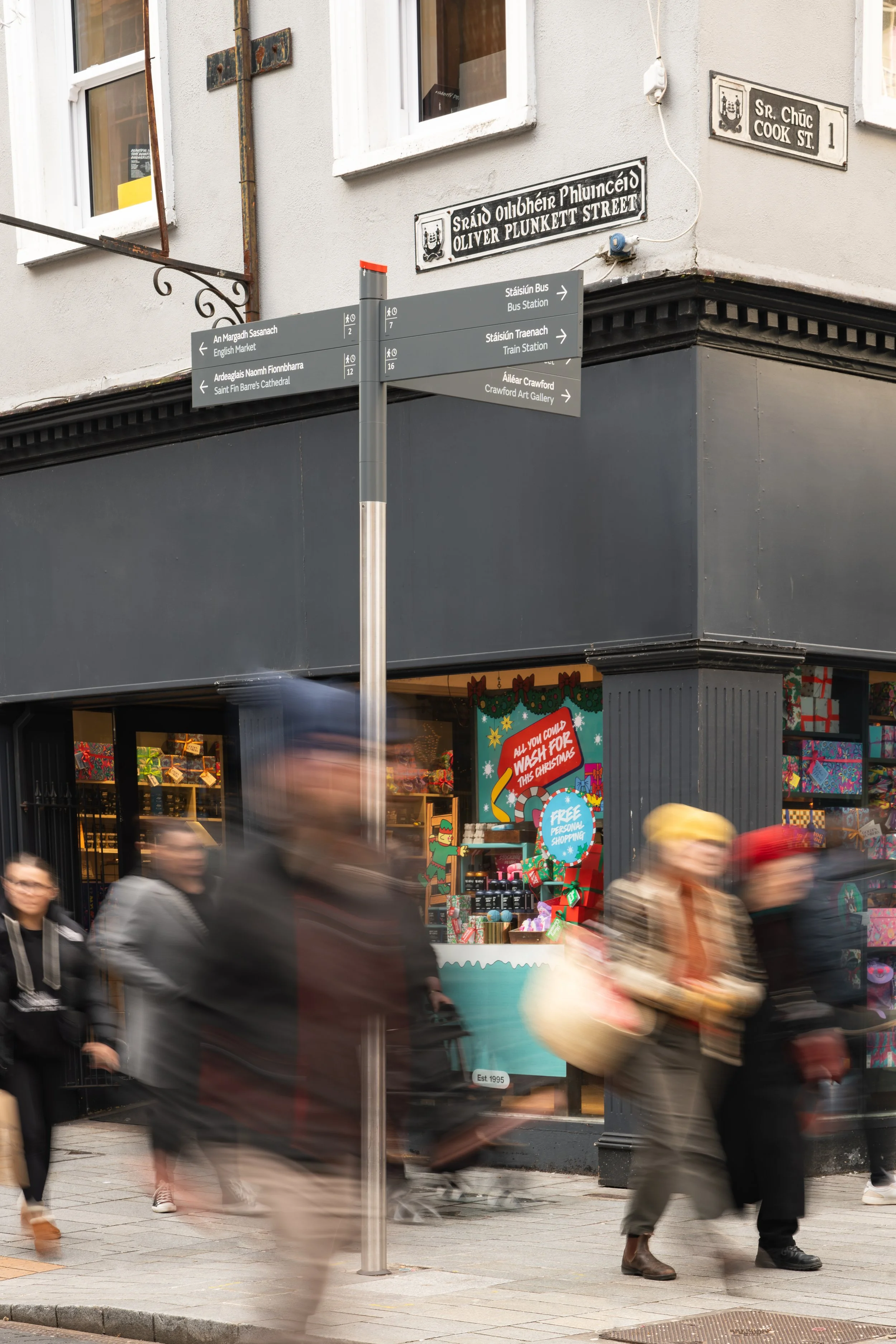
New signage totems and monoliths present detailed location maps with ‘heads up’ orientation to help people better determine their current location, and also inform them what lies within walking or cycling distance. A mixture of heritage and contemporary imagery and bite-sized nuggets of history and cultural heritage interpretation help create a unique sense of place for for Cork City.
““This signage network
helps visitors and residents alike to actively engage with their surroundings””
Research
Content Development
Site Survey and Signage Audit
Concept Design
Detailed Design
Artwork
Project Management through Construction and Handover